


Flooding is one of the most common and costly natural disasters that can impact any community, including Charlotte County. Whether you live near the coast, along rivers, or inland, flooding can occur during torrential downpours, hurricanes, or even normal rain showers. This webpage provides comprehensive information to help you understand flood risks, flood zones, insurance, property preparedness, and the actions you should take before, during, and after a flood event.
Our goal is to ensure every resident and visitor in Charlotte County is informed, prepared, and safe.
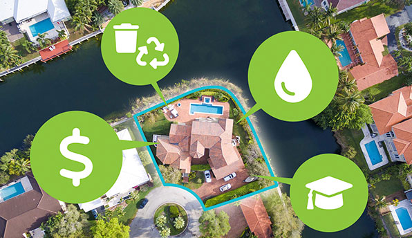
Forerunner
Charlotte County has launched Forerunner, a user-friendly online platform that provides easy access to floodplain information. Whether you are a homeowner, contractor, real estate or insurance professional, Forerunner helps you understand flood risk and meet FEMA floodplain requirements more easily.
- Look up flood zone information and base flood elevation (BFE) on a property
- Download available elevation certificates
- Submit digitally signed elevation certificates through the portal
- Contact floodplain coordinators directly with questions or documentation
Forerunner is part of Charlotte County’s continued commitment to public safety, transparency, and compliance with FEMA’s National Flood Insurance Program (NFIP).
To help you get started with the platform, we’ve provided a series of short video tutorials below. These walk you through the most common tasks, including how to search for property information, download elevation certificates, and submit documents online.
Whether you’re a first-time user or just need a quick refresher, these videos make it easy to navigate the platform and find the information you need.
Flood Hazards and Flood Risk
Charlotte County is a low-lying region with diverse flood risks. It is home to the Peace and Myakka Rivers, which flow into Charlotte Harbor, along with numerous tributaries and creeks prone to flooding. The County has extensive shorelines along these waterways, Charlotte Harbor, the Gulf of Mexico, and nearby barrier islands, all of which contribute to flood vulnerability.
- Hurricanes and tropical storms bring heavy rain and wind that can cause and storm surge.
- Significant rainfall events, either intense over a short period or prolonged over time.
- King tides with or without a westerly wind.
- Rainfall upstream or inland, which can cause rivers to rise and flood parts of Charlotte County even without local storms.
- Rising sea levels: Increasing coastal flood risks over time due to climate change.
Flood Zones and Maps
- High-risk areas (Special Flood Hazard Areas or SFHAs): Areas with a 1% annual chance of flooding (often called the "100-year flood"). Flood insurance is mandatory for federally backed mortgages here. These flood zones start with the letter A or the letter V. The V flood zone is for areas that are impacted by waves of over 3’. Construction must include pilings and piers and the bottom area is generally reserved for parking and storage and access to the living areas above.
- Moderate- to low-risk areas: Areas with lower flood risk where flooding can still occur. Nationally, 25% of all flood claims come from this area.
The Coastal A Zone is a regulatory zone (area) that identifies areas where wave action of between 1.5’ to 3’ can occur. Construction in this area must be regulated to the highest V-Flood zone standards.
Charlotte County uses the NAVD88 vertical datum system to measure elevations accurately, which is critical for floodplain management and construction regulations. Our flood maps are in NAVD88 datum as well.
Find Your Flood ZoneCoastal A Zone NAVD88 Vertical DatumHistorical Flooding in Charlotte County
Charlotte County has a history of flooding due to excessive rainfall and storm surge events. The following is a listing of dates in which Charlotte County residents have submitted flood insurance claims to the National Flood Insurance Program. The dollar figures reflected in the figures below include damage to county infrastructure, along with damages to homes and businesses.
• Oct. 2024 - Hurricane Milton: Twelve days after Hurricane Helene, Charlotte County was impacted by Milton. Storm surge levels of 5 to 8 feet were recorded throughout the county, including up the Peace River. The county completed more than 5,900 damage assessments, revealing that over 2,500 structures sustained major damage, with approximately 250 homes destroyed - primarily due to storm surge.
• Sept. 2024 - Hurricane Helene: Heavy rainfall was coupled with a storm surge ranging from 3 to 5 feet. A total of 8 structures were completely destroyed, while over 2,000 others sustained damage from the storm surge and flooding.
• Aug. 2023 - Hurricane Idalia: Charlotte County experienced storm surge inundation of 2-4 feet, accompanied by 5 to 7 inches of rainfall and tropical storm-force winds between Aug. 28 and 31, 2023.
• Sept. 2022 - Hurricane Ian: Hurricane Ian made landfall as a Category 4 storm, bringing severe winds to Charlotte County. The storm's eye passed through Charlotte Harbor and along the Peace River. While the northern part of the county experienced little to no storm surge, the southern region saw inundation exceeding 4 feet. Intense rainfall led to severe flooding along the Peace and Myakka Rivers. Sustained winds of 90 mph, with gusts reaching up to 143 mph, were recorded before weather stations ceased transmission. More than 200 homes were destroyed, primarily due to wind damage.
• Sept. 2017 - Hurricane Irma: Estimated $5 to 6 million in damage to private and public resources caused by this powerful hurricane hitting Charlotte County as well as the majority of the State.
• Oct. 2005 - Hurricane Wilma: Heavy rains of 4 to 8 inches caused urban street flooding and filled ditches to capacity.
• Aug. 2004 - Hurricane Charley: Estimated $5.4 billion in damage to private and public resources caused by this powerful category 4 hurricane hitting Charlotte County and proceeding up the harbor to Desoto County.
• June 2003 - Excessive Rainfall: Between 16” and 20” of rain fell across the county within a 24-hour period. Approximately $4.7 million in damages occurred to public infrastructure. 41 living units were affected with an estimated $50,000 in damage.
• Sept. 2001 - Tropical Storm Gabrielle: Direct hit from tropical storm caused widespread flooding along Shoreview Drive and Gulf Blvd. Significant flooding also took place in the City of Punta Gorda. Over 300 homes were affected with minor-moderate levels of flooding. Estimated damages to infrastructure, residences, and businesses are between $4-6 million.
• Sept. 2000 - Hurricane Gordon: Passing hurricane caused flooding in the Manasota Key area along Shoreview Drive and Gulf Blvd. Other areas included the Peace River shoreline area in Punta Gorda. Flood Insurance claims totaled over $132,584.02.
• Sept. 1999 - Tropical Storm Harvey (no landfall): Passing tropical storm caused flooding in the Manasota Key area along Shoreview Drive and Gulf Blvd. Minor flooding occurred in a few homes. Flood Insurance claims were totaled over $21,592.40.
• Sept. 1998 - Hurricane Georges (no landfall): Passing hurricanes caused abnormally high surf, causing beach erosion and threatening some homes, putting water in a few on Manasota Key; flood insurance claims of $3558.50.
• Sept. 1997 - Excessive Rainfall: Up to 10" of rain fell in Port Charlotte causing widespread street flooding in Charlotte County; some houses sustained water damage; $15,846.79 in flood insurance claims were paid out.
• Oct. 1996 - Tropical Storm Josephine (no landfall): Some street flooding occurred, Englewood experienced some flooding from high tide; high tide eroded beach and caused one home to fall into the water; $253,631.39 in flood insurance claims were paid out.
• March 1993 - Winter Rainstorm: Flooding caused by high tides coupled with blowing winds; flood insurance claims of $383,008.69 were paid out.
• June 1992: Flooding due to 6 days of rain 23.5" of rain fell in Murdock, 18" fell in Punta Gorda, and 28" fell in Englewood; approx. $1,600,000 in damages was reported.
• Nov. 1988 - Tropical Storm Keith: Approximately 2" of rain fell in Charlotte County; flooding occurred in Punta Gorda and other low-lying areas due to high tides coupled with a minimal storm surge. Flood insurance claims of $224,384.60 were paid out.
• Sept. 1988 - Stalled front with excessive rain: Homes in Grove City suffered damages from flooding, none of which were uninsured; 11.5" of rain fell in Englewood, with 7.5" in Punta Gorda and 4.5" in Port Charlotte. Flood insurance claims of $1,066.51.
• Aug. 1985 - Hurricane Elena (no landfall): Storm surge caused flooding of up to 5' in some areas. Flood insurance claims of $161,356.46 were paid out.
• March 1983 - Abnormal High Tide: Flooding occurred in the City of Punta Gorda. Flood insurance claims of $7,967.89 were paid out.
• June 1982 - No-Name Storm: Several inches of rainfall along with a minimal, but damaging storm surge; approx. 10,965 acres of land flooded with salt water; approximately 1800 acres of land flooded with fresh water rain runoff; damage estimates approx. $1,000,000.
• June 1972 - Hurricane Agnes (no landfall): 5"-7" rainfall in Charlotte County; caused flooding of 3"-6" in parts of County; damages approx. $62,105.
Where to Learn More and Get Assistance
- Floodplain Coordinator: 941.743.1469
- Charlotte County Community Development Department: 941.743.1201
- Email: BuildingConstruction@CharlotteCountyFL.gov
You can also visit your local library or county offices to access flood maps, guides, and educational materials.